Frequently Asked Questions
Q: Why is this development proposed?
This site is identified by St Edmundsbury Borough Council as capable of delivering a Sustainable Urban Extension of around 2,500 homes in its Core Strategy, and now has a specific allocation in the adopted Haverhill Vision 2031 document. This decision was made following a number of years of consultation.
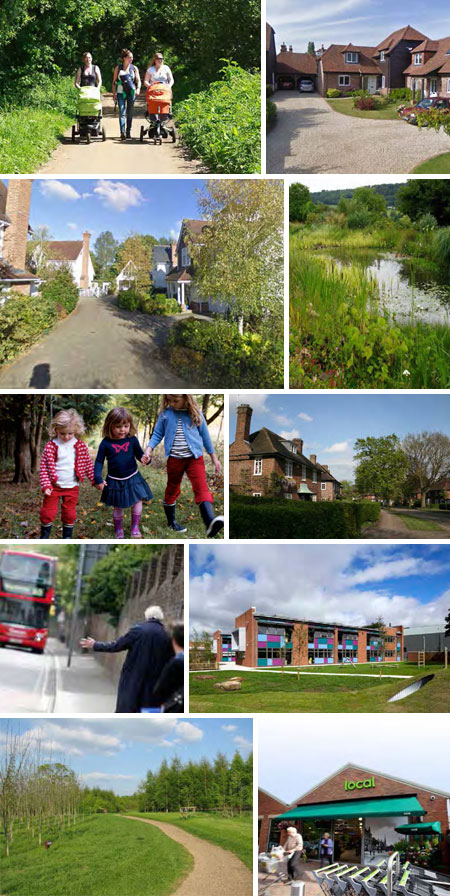
Great Wilsey Park will deliver an exemplary scheme which is well connected, inclusive and designed to the highest standards. The masterplan has been landscape-led and as a consequence seeks to ensure that new development is well integrated into its surroundings and provides social spaces which promote health and well-being.
In addition to providing attractive quality homes for first time buyers, families and the elderly, this characterful new £300 million development will create approximately 370 new jobs in the health facility, new schools and business space on the site. The new residents living on this development will ultimately bring around £45 million in new expenditure each year, boosting shops and services, helping to support a further 340 jobs in the wider economy.
Q: Why are brownfield sites not being used instead?
Brownfield sites are being delivered in the area but there are not enough to accommodate all of the homes needed. It is also important to retain some of the brownfield sites to provide employment opportunities for the future.
Q: How will local roads cope with the development?
There will be a multi-million pound package of transport improvements to facilitate the development. In addition, the North West Growth Area will provide a relief road for Haverhill which will positively change driver culture and alleviate queuing in currently busy areas.
Through transport modelling, a number of off-site road mitigation measures are required to increase capacity to acceptable levels. The Transport Assessment which is being provided as part of the planning application will clearly set out all mitigation and upgrade proposals required for the implementation of the development. The Transport Assessment is currently being consulted on with the Suffolk County Council transport team to ensure that the requirements and aspirations of the local authority are positively addressed and included. Essex County Council are also being consulted as part of this process.
Q: Will there be off-road cycle paths to encourage safe, sustainable travel into town?
The development will provide improved and additional public transport, footpath and cycle links to the town centre and other significant leisure, employment and service destinations. A dedicated off-road pedestrian and cycle link will run throughout the green spine of the proposed development.
Q: Can the roundabouts in the area be better co-ordinated?
The proposed site access from the A143 is currently envisaged to take the form of a roundabout, with associated diversion of the A143 into the site on both approaches along Haverhill Road. A second roundabout will also be required to serve the North West Haverhill development which is coming forward separately. In technical terms they both achieve sufficient visibility and safety criteria and do not adversely impact on one another.
Q: How will the roads be delivered to fit with the phasing of the development?
It is anticipated that Great Wilsey Park will be delivered in three phases, although the phasing proposed within the masterplan is indicative to allow future flexibility so that the delivery of the site can respond to market demand.
Roads to service each phase will be considered as part of subsequent detailed planning applications for each phase. The distribution of trips proposed for the development will dictate the likely route and destination any new traffic will take into Haverhill, with roads being designed accordingly.
The first phase seeks to ensure a primary link between Haverhill Road and Chalkstone Way, as well as the delivery of a local centre, school, health centre and employment space. New woodland planting will also be undertaken along the northern boundary, alongside woodland planting along the northeast and eastern boundaries prior to the commencement of the second phase.
At this stage, there would be the delivery of a second community hub (local centre and school), whilst the third phase completes the development and enables pedestrian and cycle linkage between Haverhill Road and Coupals Road. No road access is proposed from Coupals Road into the development. Throughout the duration of the development the existing Public Right of Way network would remain open and connected at all times.
Q: Is the access point onto Chalkstone Way safe?
The access point from Chalkstone Way has been considered and designed with discussions with the highways authorities. The current location is considered optimal in terms of both good vehicular capacity and pedestrian safety.
Q: How can we be sure that the infrastructure will actually be delivered?
A Section 106 legal agreement will provide certainty in terms of the delivery and phasing of infrastructure and investment alongside housing delivery. Both the developer and the Local Authority would sign this document.
Q: Will be there investment and improvements to Haverhill Town Centre and the local retail offer?
The two neighbourhood centres proposed by the development will act as community hubs, providing local shops and services. The existing local centre on Strasbourg Square is located within 800m of the site; this will serve the southern area of the site, which will be mutually beneficial for the new residents and the existing services in the centre. The new residents of the proposed development will add vitality to the existing shops in Haverhill town centre as well as attracting new retailers with their additional spending power.
Q: Where will the new residents work?
Great Wilsey Park will deliver approximately 370 new jobs in the schools, new healthcare facility and the shops and services which would be delivered on the site. The development makes provision for employment space including small units for start-ups and grow-on space.
Q: What will be provided in terms of healthcare?
Healthcare provision is included within the proposals. Meetings between the developers and the two local doctor’s surgeries and the healthcare area action team have taken place. We are continuing to discuss this in order to understand what is required and how this can be delivered within the development as part of the healthcare facility.
Q: How will the emergency services cope?
This will be fully considered by the planning application process and the fire service and police will be consulted. It is likely that the developer will pay a Section 106 contribution towards both the police and fire service. Furthermore, new housing will raise additional Council Taxes which will in turn contribute towards the emergency services.
Q: What facilities will be available at the local centres?
Each local centre to be provided as part of the proposed development will seek to provide a variety of facilities which could include convenience shopping, takeaways, a pharmacy, a cafe, a laundrette and toilet facilities, to give a few examples. Community space is proposed which could be hired for a variety of uses, including religious meetings.
There is also potential for a community café to be incorporated as part of the Country Park which could provide tourist information.
Q: What recreation facilities will be available in the Country Park?
Play areas for children of all ages are included in the proposals, as are picnic areas; the location of the latter is flexible and is not yet determined. Informal open spaces will also be provided throughout the development, and formal sports pitch provision will be delivered at the schools, most likely for community use outside of the school day. Woodland trails will be incorporated into the development, and a continuous pedestrian/cycle link will be provided along the length of the Country Park.
Although a number of respondents requested a lake, this is not sustainable, nor viable, within the development. However there will be a large number of attenuation ponds which will contain permanently wet areas and will generate the positive benefits of biodiversity and ecological growth.
Q: How much green space will there actually be?
72.1 hectares (178.16 acres) of open space will be provided by the proposed development. This equates to 42.8% of the total development site area and is in excess of the Borough Council's open space requirements.
Q: How will wildlife be protected as the site is developed?
As part of the development, we will improve biodiversity on the site, providing new opportunities for habitat creation. Existing hedgerows, woodland, ditches, hedgerows and watercourses will be protected where possible, and enhanced through active management alongside additional planting and habitat creation.
The development will also deliver allotments, and extensive areas for recreation. New green infrastructure which will include broadleaved woodland, specimen trees, hedgerows, allotments, orchard trees areas of parkland, conservation grassland, and wetland habitats will significantly enhance the site’s landscape and bio-diversity by diversifying the area’s tree structure, providing increased habitat creation and connectivity. Woodlands will be managed to seek a balance between public interactions and biodiversity requirements; public access will be restricted from some parts to allow for the creation of ‘ecological havens’. Full ecological assessments have informed the Masterplan and will be submitted in support of any future planning application.
Q: How will the development be designed to avoid it feeling like another housing estate?
The design of the development will be landscape led and will embrace current guidance for the design and development of ‘Garden Suburbs’, which includes well connected and bio-diverse public parks, high quality gardens, tree lined streets and open spaces, opportunities for people to grow their own food and links with the community in order to get local people involved in the management of their open spaces.
It is envisaged that Great Wilsey Park will be comprised of three distinct neighbourhoods, linked via a linear ‘Green Spine’ or Country Park. These neighbourhoods have been termed for the purposes of identification - Great Wilsey Meadows, Chalkstone Fields and Mary Cole’s View. At this stage character areas are principally intended to shape the form of the development. Further detail concerning architectural detailing, materials and street widths, is to be agreed with the Local Planning Authority at the detailed design stage. Indicative townscape character is illustrated in the Masterplan and further detail concerning architectural detailing, materials and street widths is to be agreed with the Local Planning Authority at the detailed design stage.
Great Wilsey Park has the capacity to provide an enduring and sustainable mixed use development of up to 2500 new homes, including homes for first time buyers, families, affordable homes, self-build, executive houses and specialist houses for the elderly, with strong links to a health centre and local shops. Housing will vary in size, style and tenure, ensuring variety and diversity across the site. All housing will be developed in accordance with standards for lifetime homes.
Q: How will the Country Park be given a sense of identity?
Great Wilsey Park will include public art works within key locations such as site entrances and egress points, community hubs and along the ‘Green Spine’. The location and form of public art within the site will be directed by a steering group containing representatives of St Edmundsbury Borough Council, Hallam Land Management Ltd, the landowner and other stakeholders as appropriate.
Q: Why are there two primary schools and will there be any nursery or secondary provision?
The two primary schools to be provided by the proposed development are in accordance with the requirements of Suffolk County Council as the Local Education Authority. It is also likely that a financial contribution towards secondary school education will be provided by the proposed development, secured via a Section 106 Agreement. Land will also be gifted to Samuel Ward Academy to enable its expansion. Nursery provision will be reviewed.
Q: Two options are included in the Masterplan, one which proposes a driving range and one which is purely the Country Park. Which one will be progressed?
Which option is pursued will be confirmed through the planning application and informed by the consultation responses received.
Q: How will the green space be managed and funded?
The ongoing management and maintenance of green space throughout the site will be considered as part of the planning application process and secured via a Section 106 Agreement, which the Council and landowner will sign up to.
Q: How will run-off be mitigated in order to avoid flooding downstream?
The existing tributary of the River Stour that flows through the site will be protected and enhanced with targeted clearance and additional habitat creation. Surface water will not be permitted to flow directly into this watercourse and must first be attenuated and its outflow regulated to a discharge rate agreed with Suffolk County Council to ensure that there will be no adverse effect of the proposed development in terms of flooding downstream.
A Sustainable Drainage System is proposed (SuDS) which will comprise a series of attenuation basins interconnected by swales. Attenuation basins will be designed to sit sensitively within the landscape and will feature wetland areas for habitat creation and biodiversity enhancement.
The attenuation basins have been sized to accommodate the largest defined storm event as derived by the Environment Agency. The ongoing management and maintenance of SuDs throughout the site will be considered as part of the planning application process and secured via a Section 106 Agreement which the Council and landowner will sign-up to.
Not only will the sustainable drainage be designed to ensure run off rates are no faster than existing rates, preventing downstream flooding, they will actually improve upon the present day runoff rates by a minimum of 20%.
Q: Will the new development be eco-friendly?
The proposed development could incorporate opportunities for renewable energy generation, passive design, energy efficiency, and minimising water consumption.
Q: How will Kedington be protected?
The existing ridge line screens development from Kedington, no development takes place along or over this ridgeline. In addition a belt of tree planting ranging in width between 15 and 35m is proposed around the development's edge.
The Local Plan (Haverhill 2031) does not allocate any land between the ridge line and Kedington for development, nor does the road layout allow for any future development. As the land beyond the ridge line is far more sensitive and is less logical in terms of development potential, it is very unlikely that this would ever come forwards in the future for development as this would start to infringe on the individual edges of these settlements.
Q: How will the sewage network cope?
Anglian Water has confirmed that the existing foul water sewer network surrounding the development does not have capacity to accommodate the site. However, the Haverhill Water Recycling Centre located to the west of the town does have sufficient capacity to accommodate the site via a newly created direct connection. There will be a new foul water pumping station onsite, with approximately 1.45km of new foul water sewers which will convey all foul water from the site directly into the Water Recycling Centre. The route of the new sewer off-site is to be determined by Anglian Water, with all construction works to be designed and implemented to keep public disruption to a minimum.
Q: How will the water supply cope?
From early in the inception of the development the project team has consulted with the statutory utility authorities to understand and establish the necessary supply requirements for the site. All requirements for supply of electricity, gas, water, telephone/broadband and foul water are known.
Anglian Water has confirmed that it is able to reinforce its existing water supply network to accommodate the development. No existing properties nearby will be adversely affected by these works .There are a number of off-site reinforcements to existing utility apparatus required, however, these have been costed into the development and are wholly viable to undertake. All aspects of new utility supply will be provided as an over and above the current capacities which serve Haverhill, and as such will not impact whatsoever on existing property supply needs. Finally, a careful construction management plan will be implemented to ensure that all off-site utility reinforcements are conducted in a manner that is both safe, swift and of as little disturbance to the public as possible.
Q: Has the masterplan changed to take on board comments raised during the consultation?
Yes the key changes following the recent and previous consultation activities include:
- No link road is provided to Coupals Road.
- The tree belt/woodland along the western/south western edge has been retained along with the farm track.
- The proposals for the Country Park, habitat, café and potential golfing facilities have taken on board comments raised by residents and groups. Further consultation feedback will inform the final design.
- The buffer planting for Calford Green has been proposed following consultation with local residents.
- The number of points of crossing over the green infrastructure within the scheme have been reduced following discussions and feedback with the authorities.
- The positioning of the extra care area has changed in response to various stakeholder comments and to create a greater sense of connection between the extra care and proposed local hub.
- A healthcare facility has been incorporated within the proposals following consultation with residents and healthcare providers.
- The siting of the allotments has moved to ensure they are more central and accessible to all residents of the development.
- The main access and local centre have been repositioned to ensure that they are adjacent to the land gifted to Samuel Ward to enable future access to that land and also to provide connectivity, bus links and parking provision for all of these areas so it is a very valuable community resource linking the school and local centre.
- Green corridors have been widened to improve biodiversity and connectivity to existing areas of parkland to encourage better pedestrian access between Haverhill’s green spaces.
- Consultation with local residents has enabled tweaks to be made to the design for the roundabout access to the north of the site.
- The facilities proposed for the development have been informed by suggestions made during the consultation process.
- The number of play areas has increased and these have been redistributed within the masterplan to allow for more accessibility.